• Notice for iPhone users: DO NOT use the image size reduction option when uploading photos to the forum. This causes portrait images to post as landscape. We have added a warning to the image insert pop-up as well.

Starting on a journey

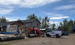
Day 8 - The big day. After a short drive made it to Dawson Creek Mile 0 of the Alcan. Stopped and took a few pictures of the big sign in the parking lot and met a lot of other travelers also starting their journey up, but I also wanted to stop at the original Alcan Mile 0 which is only a couple blocks away. This is the best picture I could get of it because it's in the middle of an active intersection and I didn't want to hold up traffic. I also happened to park right in front of the Dawson Creek visitor center where I picked up a lot of great maps for the trip. Also wanted to add that the visitors center in Grand Prarie was also a great stop, they had a complete excel spreadsheet printed out of all the stops along the alcan along with phone numbers and mile numbers. With all of the information I've picked up from these visitors centers I haven't actually opened up my Milepost that I bought for the trip.


View attachment 122378

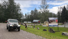
I was excited to start the journey as soon as possible, but immediately saw this sign and had to detour

View attachment 122379

View attachment 122380

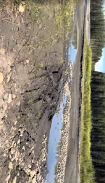
The rest of the day was just driving, rain, driving, eat, rain, and driving. Spent a lot of time exploring some of the dirt roads off the highway to lead to random streams and rivers.

View attachment 122382

Met some nice fisherman from Fort Nelson at the Sikanni Chief River who gave me a lot of great local advice on places to go and see. So, armed with local knowledge (and lack of other options in the area) we continued driving up to Fort nelson to catch the dinner buffet at Triple G hideaway.

After dinner we went to check out one of the local camping spots along the Muskwa river, but the minute we hit the river bottom the rain started up again, so back up to town to get another hotel room. But at least I got an awesome picture of a double rainbow while I was down there.

View attachment 122381
(y)
 
Day 8 - The big day. After a short drive made it to Dawson Creek Mile 0 of the Alcan. Stopped and took a few pictures of the big sign in the parking lot and met a lot of other travelers also starting their journey up, but I also wanted to stop at the original Alcan Mile 0 which is only a couple blocks away. This is the best picture I could get of it because it's in the middle of an active intersection and I didn't want to hold up traffic. I also happened to park right in front of the Dawson Creek visitor center where I picked up a lot of great maps for the trip. Also wanted to add that the visitors center in Grand Prarie was also a great stop, they had a complete excel spreadsheet printed out of all the stops along the alcan along with phone numbers and mile numbers. With all of the information I've picked up from these visitors centers I haven't actually opened up my Milepost that I bought for the trip.


View attachment 122378

I was excited to start the journey as soon as possible, but immediately saw this sign and had to detour

View attachment 122379

View attachment 122380

The rest of the day was just driving, rain, driving, eat, rain, and driving. Spent a lot of time exploring some of the dirt roads off the highway to lead to random streams and rivers.

View attachment 122382

Met some nice fisherman from Fort Nelson at the Sikanni Chief River who gave me a lot of great local advice on places to go and see. So, armed with local knowledge (and lack of other options in the area) we continued driving up to Fort nelson to catch the dinner buffet at Triple G hideaway.

After dinner we went to check out one of the local camping spots along the Muskwa river, but the minute we hit the river bottom the rain started up again, so back up to town to get another hotel room. But at least I got an awesome picture of a double rainbow while I was down there.

View attachment 122381
(y)
 
Day 9 - At the recommendation of the locals, we visited the Fort Nelson Heritage musuem

1785693128894.png

It's actually has a pretty large outdoor display of cars and equipment from the building of the Alcan

1785693205744.png

It's worth visiting if you're driving through, and it's a break from all the seat time in the jeep.

While driving through Hinton a couple days ago, I had an idea on how to fix my wipers. I needed some type of spring to keep constant pressure on the wiper linkage to prevent it from over rotating. So after searching through all the aisles for a spring, or even some stiff wire and not being able to find anything, I happen to see this while walking out of the store

1785693410000.png

So while my son was enjoying skipping rocks by the side of some river, I was fashioning a coil spring from an egg whisker.


1785693502955.png

Stopped by Tetsa River Lodge for one of their famous cinnamon rolls. And it's still raining. But the spring seems to be working.

1785693564187.png

Forgot to mention while we were down by that river, I thought i could make it across to a sandbar. I was wrong. A half hour of back and forth this is what it looked like. I have some dash cam video of the incident but in the moment didn't think to take video of the escape.


1785693838567.png

1785693986613.png

The upside is the constant rain is washing away most of the mud.
 

Attachments

  • 1785693938779.png
    1785693938779.png
    831.9 KB · Views: 6
  • 1785693804819.png
    1785693804819.png
    941 KB · Views: 6
  • 1785693756774.png
    1785693756774.png
    940.6 KB · Views: 6
It's been a while time for a quick update

All of the days have started to run together, so I'll just quickly skim over where I am

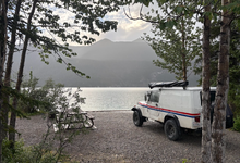
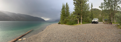
Stopped at another amazing campsite at Muncho lake, but of course it was still raining and all of the spots were reserved, so we kept going
1786087885492.png
1786087932684.png

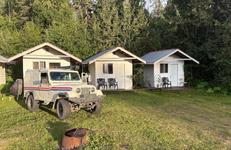
We kept driving to Liard Hot springs, where we managed to get the last tiny cabin available. It's exactly what it sounds like, a tiny cabin. Just a bed and cabinet with electricity, but at least it was dry

1786088035451.png

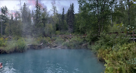
The hot springs were amazing, I can see why everyone says this is a must visit destination. Especially after driving all day, a soak in a hot springs really relaxes the muscles. Since we arrived so late we only had an hour to use the springs, but it was still worth the price of admission. I think it was only $5 Canadian.
1786088122630.png
 
After a good nights sleep at Liard, we headed off for the day. Weather forecast hasn't changed much, but at least the wipers seem to be working ok now.

1786088358660.png

Saw a herd of bison along the side of the road. I forgot to mention the previous day we saw a road kill moose on the side of the road. A word of advice, don't go up to inspect a dead moose that's been decomposing. The smell stays with you and I was feeling nauseous for the next half hour.

1786088430832.png
Also saw a bear eating something it killed off the side of the road
1786088556298.png

From then it was more driving until we hit Watson lake and the signpost forest. You can look up the history of it but the quick summary is that it was started by a homesick soldier in the 40's posting up a sign of his hometown, and now it's grown to over 100,000 signs. A very interesting exhibit and fun to walk through the maze of signs looking for places near my hometown.

1786088617392.png
1786088679821.png

Rained some more so we grabbed a motel in Teslin.
 
The next morning I woke up early and did a little maintenance on the jeep. It started somewhere in montana with a popping sound during deceleration, and by the time we got to the border it was a full blown exhaust leak. Because it came on slowly, and with all the other issues I was having, I classified it as a "tomorrow problem" and managed to ignore it. But I knew it was getting bad when the border agent told me to turn off my engine because she couldn't hear me.

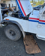
I tightened the exhaust manifold bolts and exhaust flange as much as I dared, but didn't want to risk breaking anything. Seemed to improve it somewhat, it still leaked when cold but once warmed up it sealed a little better.

1786088929833.png

From there we visited Carcross, home to the worlds smallest desert, and picked up some cinnamon rolls and bread from the local bakery.

1786089198693.png

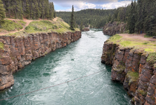
Then on to Whitehorse where we hiked up Miles canyon. I didn't realize until I saw the news later, about an hour before we got there someone had to be rescued after jumping or falling into the river.

1786089293101.png

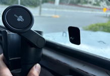
Also, the roads broke my phone holder, so I found a spare bolt and just bolted what was left to my magnetic cup holder.

1786089443034.png
 
First stop after waking up in Whitehorse was the Canadian Tire to pick up some essentials. I had been looking for some Rain-x since Hinton but it wasn't until Whitehorse that I was able to find any.

1786089532796.png

Also ended up fixing my exhaust leak by removing the exhaust flange and cleaning up the stud. I wanted to wait until I was in Whitehorse before doing anything just in case I broke a bolt or something. At least in Whitehorse i have a much better chance of being able to repair something.

Also spent $150 Cd on an oil change.

Before leaving Whitehorse, we stopped by Sargent Greg which is a Laser Tag/escape room/mini golf on the edge of town just for some relaxation and to give my son a break from all the driving. I just wanted to mention that because every Canadian I've met has been amazing, and if you're ever in Whitehorse and need a break, give this place a visit. Not only is it the only mini golf in within 1000 km, it's a nice break from the monotony because if you're in Whitehorse, you've probably been doing a lot of driving.

From then it was just a lot of driving, but finally got to camp at Moose creek campground since it wasn't raining.

I was so tired I forgot to take pictures. The long days of driving are starting to take a toll
 
Last edited:
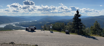
Next day we finally made it to Dawson City. Walked around town, ate some lunch at one of the few restaurants that were there. It was during the weekend of Moosehide Gathering, which is a yearly festival a few miles outside town that you can take a boat shuttle to. Hung out there for a few hours then decided to check out Midnight Dome, which another fellow traveller recommended. The road up to it is STEEP, I'm glad it wasn't that hot because I had to shift down to 1st gear for some of the sections.

1786090114501.png

Since it was the annual Moosehide Gathering, the town was pretty full and there were no hotel rooms or campsites available. Stopped by the local RV park to have a shower and fuel up, then decided to head up the Dempster.

1786090637590.png

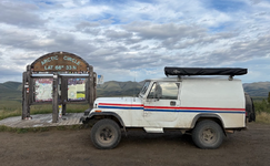
One of the first signs you run across as you start the Dempster. I don't know what that is in miles but it seems like a lot

1786090743214.png

Drove though Tombstone Park, couldn't get a site at the campground so we stopped at the Interpretive center where it seems a lot of people camp in the parking lot. But since it was relatively early (9pm) and we had quite a few more hours of daylight left we kept driving. We found many nice looking campsites along the road, but every single one of them was overrun with mosquitoes. It was so bad that you almost couldn't breathe without inhaling a mosquito. So while they make great pictures, they're not that fun to camp in so we ended up pulling into a gravel pit and just sleeping there.

1786090871878.png

Not nearly as scenic, but the tradeoff was worth it. Still had mosquitoes, but they were manageable.

1786091027898.png
 
For those that are unfamiliar with the Dempster Highway, it's one of two roads in North America that lead to the Arctic Ocean, and the only one where the public can drive all the way to the end. The other one is the Dalton Highway in Alaska which ends at the oilfields in Prudhoe bay about 7 miles short of the Arctic ocean. The Dempster is almost entirely unpaved for 500 miles, and only has a couple of towns along the way.

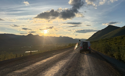
I have a ton of pictures, but not much to say because it's essentially drive, stop for a photo or lunch, then drive some more.

1786092274100.png
1786092357855.png
1786092468113.png

The rough roads of the dempster started making my transmission cooler loosen up, so zip ties to the rescue.

1786092844803.png

I think it was the second night on the Dempster that all the driving took it's toll on my body. It could have been the constant pounding of the potholes or washboard, parts of the Dempster are really, really bad. Somewhere during that night, between starting a campfire in the pouring rain or rearranging my food box, I twisted my back so bad I could barely stand. Getting into the jeep was a chore, I couldn't even sit up or move around. Normally I would sleep with my head facing the rear door, but that night I hd to use the roll bar to pull myself in and sleep with my head against the back of the seats.

Fortunately, once i was able to get into the drivers seat after a lot of grunting and moaning, I was able to keep driving.
 
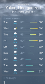
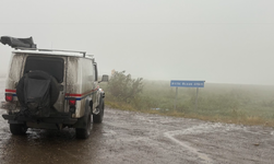
I have a feeling I'm just following a storm heading north, and that I've been under the same rain cloud for the past week an a half. The rain comes and goes for a while, but everything is still wet.


1786093020329.png

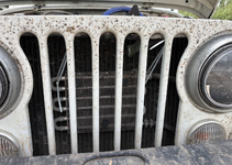
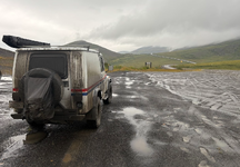
All that rain turns the dempster into a muddy, slippery mess. I have to be real careful getting out of the car, because the side steps are covered in mud that feels more like axle grease.

1786093123176.png

1786093240455.png

The rest of the drive is beautiful, but relatively uneventful. Except the roads broke the latch on my spare tire carrier, so that's another thing i gotta fix in the middle of nowhere. Luckily I'm able to use some bungee straps to hold it mostly closed until I figure out a solution.


1786093323600.png
 
Back
Top