• Notice for iPhone users: DO NOT use the image size reduction option when uploading photos to the forum. This causes portrait images to post as landscape. We have added a warning to the image insert pop-up as well.

Starting on a journey

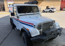
@ducktapeguy thank you for the interior shot of the Postal at the museum. This finally clears up for me why there are two large pipe clamps on my roll bar.

 
Then off to Tok for the night. I'm assuming Tok is named that because these people didn't know how to spell Chicken. I just realized I didn't take any pictures in Tok. We basically got in a little late, ate dinner, slept, and left the next morning because I was in a rush to get somewhere special
What I was told (which isn't real, but fun) is that the name Tok came from the fact that you drive NE out of Anchorage to head back S/SE back to the border (or N/NW to Tok from the border and turn SW at Tok) and you basically have one turn, at Tok.

So the name came from "Turn, ok?" :rotfl:
 
Just a side note. I joined as a gold member and I got access to the LIKE BUTTON. Ain't life like a box of chocolates. Sorry not trying to highjack your awesome post just wanted to let the world know. :bacon:
Awesome.
 
That is seriously the trip of a lifetime, for you and your son! Thank you for letting us live vicariously through your adventures! :thumbsup:
I just noticed you're from Marysville. I actually wanted to stop by there one of these days to visit Gallery One to meet Brian Shul and get a copy of Sled Driver or a T-shirt. It's unfortunate I never made it up there before he passed. IMO the SR-71 will aways be the coolest plane ever made
 
It's been a while since I posted updates, so I'll try and get caught up.

After the museum, we went to Anchorage to eat a good meal and stay in a hotel. Unfortunately my son needed to get back in time for school and we wouldn't have time for the drive home, so after dropping him off at the airport I started on the long drive home. I would've loved to spend an extra couple of weeks up there exploring Homer, Valdez, and Seward, but I was already behind schedule and needed to head home.
I tried to book a ferry from Whittier to Valdez, but because of the summer season all the spots were booked and the earliest I could have gotten a ferry would be late August. So heading back to Tok. On the way past Matanuska Glacier.

1787049013737.png

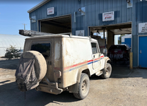
Unfortunately the weather started warming up and the vapor lock issue started to reappear. I had to stop by the side of the road a few times to let it cool. During one of these stops I ran into the family I camped next to at Tuktoyuktuk, they saw me on the side of the road and stopped to check up on me.

1787049311386.png

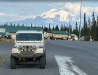
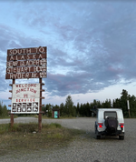
Made it to Haines Junction where I had dinner and was debating whether to drive down to Haines and take the ferry to Skagway, then come back north. That would have added an extra day to my trip.

1787049454921.png

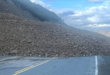
Since I was already having issues with the Jeep, and didn't think it'd be worth it to spend an extra 8 hours of driving just to pass through those towns, I decided it would be best to skip it and come back when i had more time to enjoy the area. That ended up being a good decision, that evening there was a rockslide on the road leading to Skagway, and I would've been on the wrong side of it.

1787049734025.png

So went all the way to Tok, where I spend the night at one of the local campsites

1787049826043.png
 
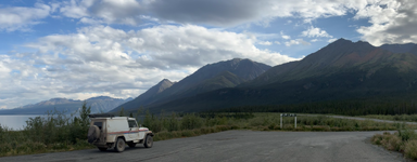
Next day was another long day of driving. I'm not stopping as often as I was when my son was with me, so I have a lot less pictures.

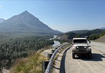
One of the many beautiful rest stops along the road

1787049890331.png

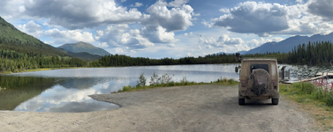
Along Kluane Lake
1787050014784.png

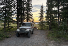
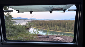
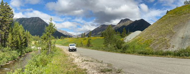
That night I found another amazing campsite taking a side road off the Alcan, and then finding a little path between the trees which ended up on the cliff next to this river. I almost drove right past it as the opening was too narrow for a motorhome, and the ditch on the side of the road would've prevented the sprinter vans or other low clearance vehicles from entering. Luckily, it was perfect for a scrambler.

1787050120202.png
 
Went to Whitehorse, where the first order of business was getting a car wash. The bugs had gotten so bad even the gas station squeegees weren't getting them off, and the caked on dirt was getting all my clothes dirty.

Before

1787050425589.png

After
1787050453122.png

If you look close it's not really that clean, there's still mud and bugs in a lot of places, but after a half hour and probably $50 Canadian, I was done washing. However, even though I tried cleaning the wheels as best I could, I couldn't get it all clean, and the leftover mud was causing an issue. I had a bad vibration above 60mph, but it took me quite a few hours to realize that since I didn't reach that speed very often. So somewhere between Whitehorse and Fort Nelson I had to crawl under the jeep with a stick and chisel out the remaining mud.

Headed into Fort Nelson for dinner and a shower at the community center. $6 for a day pass and you have access to unlimited hot showers and clean bathrooms. A great deal IMO. Then I backtracked a little and started down the Stewart Cassiar for one of the final stops on my trip

1787050893621.png


That night I camped at French Creek recreation site.
 
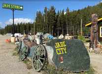
Next morning I tried to get an early start since I had another long day of driving ahead of me. First stop was Jade City, which is basically a rock shop with some RV parking.

1787050975111.png

Then up to the ghost town of Cassiar

1787051057397.png

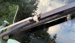
On the way down to Stewart, I drove through what I think might have been a microburst. Everything looked normal, then within seconds I'm driving through heavy rain and strong winds that were pushing my jeep all over the road. The winds were so strong it blew one of my windshield wipers off. However, because it was a narrow winding road, I had to drive another mile or two to find a place to turn around, then drive back through the storm to look for my windshield wiper. Didn't find it the first time, but as I circled around again luckily the weather cleared and I was able to find it and zip tie it back on

1787051334717.png

That night I happened to get one of the last open spots at Meziadin campground. I was going to boondock somewhere close by, but after reading about all the bear activity in the area, and seeing their electrified fence for the tent campers, I figured it'd be safer in a large campsite. At least the probability of a bear going after me is reduced with so many other people around.
 
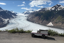
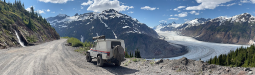
After visiting Stewart, I drove up to Salmon Glacier, I think the 5th largest and one of the few easily accessible by car. Easy might be a little misleading, as it still took a couple hours going up a very steep and kinda rough dirt road. I did have to stop once, but that was more a preventative measure rather than the jeep stalling.

1787051593823.png

I continued driving past the summit and down the other side hoping get get closer, but the road just continues on for a lot longer than I was willing to explore, so I turned around and went back up to the view point. I have to say this is probably one of the most scenic roads I've ever driving on, even more so than the Alcan.


1787051735946.png

On the way back down I stopped by the Fish Creek wildlife viewing platform. Technically I can say I saw a bear, but really I saw a bunch of movement in the trees and branches shaking, but barely a snout peaking out.

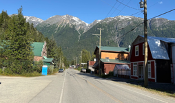
Passed through the town of Hyder, where the only thing open was a hotel and bar.

1787051993868.png

Since Hyder is technically in Alaska, you have to cross the border to get back into Stewart. Ironically, of all the border crossings I've done, this one took the longest. The customs officer kept asking me a ton of questions about what I have, what I bought, if I'm carrying anything illegal. It's strange because the only way to get to Hyder, AK is to pass through Stewart BC, and nothing in Hyder was open so there was nothing to buy. I chalk it up to the guy was probably just bored and wanted someone to talk to.

I ate dinner in Stewart, stocked up on a few supplies, then headed out because they were about the close the road for the night due to construction.

Drove all the way down to Kitwanga to camp at their municipal campground. On the drive between Stewart and Kitwanga is where I hit the most bugs I've ever seen. It was almost like driving through a snowstorm, but a snowstorm made of insects. I had to constantly use the wipers and fluid to clear the windshield just so I could see.
 
From Kitwanga to Prince george was just a very long, uneventful drive. The weather really started to warm up, so I was constantly afraid of stalling in the middle of the highway. I think i spent the night at a rest stop.

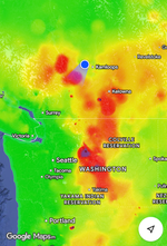
Prince George to Kamloops was much of the same. Long and relatively uneventful. I'm sure there are some places to visit in that area but at this point I'm anxious to get home.. The good news is one of the highways just opened up the day before, so I'm able to head down south rather than cutting further east. Driving between Clinton and Cache Creek was difficult. Not only was the air still thick with smoke, it was in the mid 80's, so I had the choice between keeping the windows up and suffering in the heat, or keeping the windows down and suffering with the smoke. No matter what choice I made, after 5 minutes it always felt like the wrong one. I was driving through one of the areas recently hit by the wildfires, the entire area was devastated. There were burned out shells of cars on the side of the road, and entire forests were gone. I didn't get any pictures because they didn't allow any stopping or detouring from the main highway.

1787052622729.png

The destination that night was Hope BC near the border.
 
Back
Top